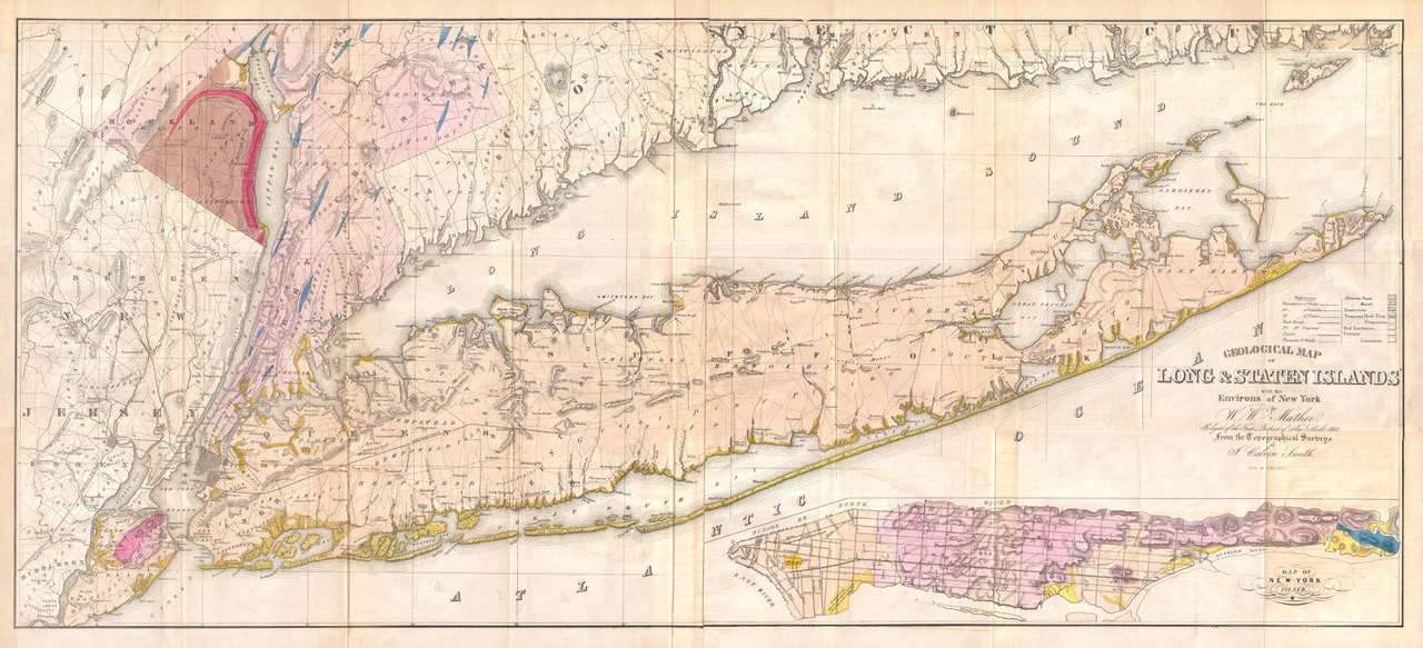
Geological Map of Long & Staten Islands with the Environs of New York. Mather, W. W., Geology of New York, Part 1, 1842. Public domain, via Wikimedia Commons.

The Huntington Historical Society, in partnership with the Half Hollow Hills Community Library, presents “The Iconic Fish: Early Maps of Long Island.” This exhibit features maps of Long Island from the 17th through the 20th centuries, with a focus on both their artistic and informative qualities. The maps on display showcase the evolution of cartography and beautifully illustrate the history and development of Long Island.
The maps are grouped into three categories: overall maps of Long Island; atlas maps; and specialty and souvenir maps. Each type of map was created for different purposes and gives us different perspectives on the island we know and love.
For example, many of the maps show the evolution of our railroad system. One map from 1842 reveals that construction on the initial route from Brooklyn to Greenport—which began in Brooklyn in 1834—stalled at Half Hollow Hills before being completed in 1844. Other maps demonstrate that the original purpose of the Long Island Rail Road was to establish the fastest route between New York City and Boston by using Long Island as a land bridge to the North Fork with a ferry service to the Stonington Line in Connecticut.
The late 19th- and early 20th-century atlas maps provide a detailed look at Towns and Villages in Huntington. They are useful records of landownership and early road names, many of which have changed over the years.
An assortment of specialty and souvenir maps shows unique ways the image of Long Island has been utilized, from advertisements, to board games, to embroidery kits.
As you go through the exhibit, try to see if you can recognize any current roads or features still around today!
“The Iconic Fish” is open February-March 2023. Located at the Half Hollow Hills Community Library, 55 Vanderbilt Parkway, Dix Hills, NY 11746. Open Monday-Friday 9:30 AM-9 PM; Saturday 9:30 AM-5 PM; Sunday, 12 PM-5 PM.
Exhibit curated by Toby Kissam, Bill Frohlich, and Emily Werner at the Huntington Historical Society. These maps are generously on loan from the Huntington Historical Society, Bill & Janet Frohlich, and Toby & Beverly Kissam.
Huntington Historical Society & Half Hollow Hills Community Library
The Iconic Fish: Early Maps of Long Island
Object List/Owners
Toby Kissam
- Map of Long Island, J. H. Colton, 1880
- A Map of Long Island, Courtland Elmer Smith, 1933, Reprinted 1961
- Automobile Map of Long Island, George Walker & Co., 1904
- Map of Long Island Railroads, Rand, McNally & Co., 1880
- Chromolithograph of Long Island, Long Island Railroad Company, 1902
- Historic Long Island, Stephen J. Voorhies, 1936
- "Long Illand Sirvaide," Robert Ryder, 1675 (reprinted 1949)
- Map of New York, Queens and Kings Counties, David Burr, 1829 (Republished by Stone & Clark, 1840)
- Map of New York, Suffolk County, David Burr, 1829 (Republished by Stone & Clark, 1840)
- Map No. 2 - United States, Cady & Burgess, 1847
- Traveller's Map of Long Island, J. H. Colton, 1847
- The Northern Part of the Town of Huntington, The Atlas of Long Island, F. W. Beers, 1873
- The Southern Part of the Town of Huntington & The Town of Babylon, The Atlas of Long Island, F. W. Beers, 1873
- Village of Huntington, The Atlas of Long Island, F. W. Beers, 1873
- The Northern Half of the Town of Huntington, E. Belcher-Hyde Northshore Atlas of Suffolk, 1909
- The Southern Half of the Town of Huntington, E. Belcher-Hyde Northshore Atlas of Suffolk, 1909
- The Village of Huntington, E. Belcher-Hyde Northshore Atlas of Suffolk, 1909
- The Village of Northport, E. Belcher-Hyde Northshore Atlas of Suffolk, 1909
- The Southern Part of the Town of Huntington, E. Belcher-Hyde Northshore Atlas of Suffolk, 1917
Bill Frohlich
- Old Long Island, Gertz Department Store, 1947
- Advertising Map, La Grange Inn, 1930s
- New York State Postcard, c. 1905
- Long Isle Land, Hand-Embroidered Map, 1928
- The Vanderbilt Cup Board Game, Manufactured by Bowers & Hard, 1907
- Map of the New York Metropolitan Area, 1826
- Map of the New York Metropolitan Area, c. 1880
- Map of the Northeast Coast of the New World, Original c. 1600, Reprinted 1849
- Atlas Map of Long Island, The Atlas of Long Island, F. W. Beers, 1873
- Map of the Northeast United States, Rigobert Bonne, 1780
- Map of New York and Maritime Canada, French, 1789
Huntington Historical Society
- Map of Suffolk County, LI, NY, Chace & Smith, 1858
- An Accurate Map of New York in North America, Published in the Universal Magazine of Knowledge and Pleasure, J. Hinton, 1780
- Geological Map of Long and Staten Islands with The Environs of New York, W. W. Mather, 1842